


GPS Live Satellite View Map is an advanced navigation app designed to provide a reliable, accurate, and intuitive mapping solution. It is ideal for those seeking real-time traffic updates, precise turn-by-turn navigation, and vivid satellite imagery—all consolidated into a single, user-friendly platform.
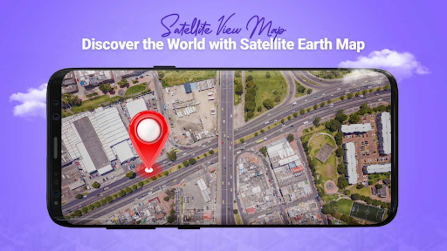
One of the most impressive features is its real-time satellite view, which allows users to see their surroundings from a bird's eye view. This feature is particularly beneficial when navigating unfamiliar areas, offering a comprehensive visual layout of streets and landmarks around you. It enhances travel and driving experiences by giving clear representations that aid in orientation and route planning.
GPS Live Satellite View Map: A Comprehensive Guide
GPS Live Satellite View Map is a mobile application that harnesses the power of GPS (Global Positioning System) technology and satellite imagery to provide users with a comprehensive and interactive map experience. This advanced tool empowers users to explore their surroundings, navigate unfamiliar territories, and access a wealth of location-based information.
Features and Functionality:
* Real-Time GPS Tracking: GPS Live Satellite View Map utilizes the device's GPS capabilities to accurately track the user's current location. This feature allows for real-time navigation and provides a precise understanding of one's whereabouts.
* Detailed Satellite Imagery: The application seamlessly integrates satellite imagery to present a detailed and realistic view of the surrounding area. Users can zoom in and out, rotate the map, and switch between different satellite layers to gain a comprehensive perspective.
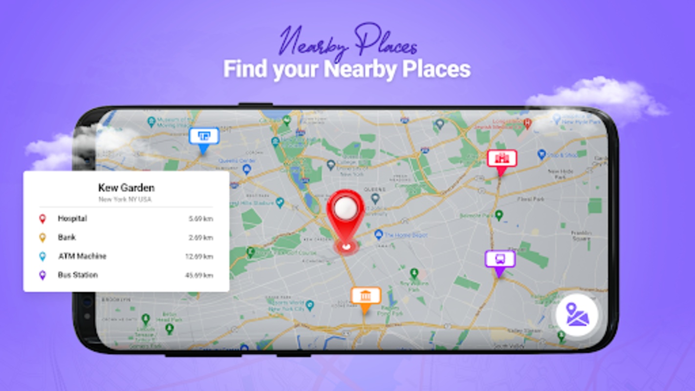
* Comprehensive Map Data: GPS Live Satellite View Map offers a comprehensive database of map data, including roads, landmarks, businesses, and points of interest. This rich information empowers users to effortlessly locate destinations, find nearby amenities, and plan their journeys.
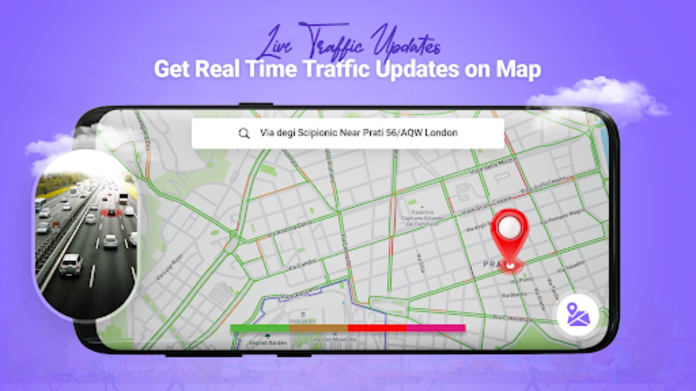
* Traffic Updates: For enhanced navigation, the application provides real-time traffic updates. Users can stay informed about road closures, accidents, and traffic congestion, enabling them to make informed decisions and optimize their travel routes.
* Location Sharing: GPS Live Satellite View Map facilitates location sharing with friends and family. Users can easily share their current location or send a live tracking link, promoting safety and coordination during group activities.
* Offline Maps: The application offers the convenience of offline maps, allowing users to access maps and navigate even without an active internet connection. This feature proves invaluable in areas with limited or no network coverage.
Benefits and Applications:
GPS Live Satellite View Map finds widespread application in various scenarios, including:
* Navigation: The application serves as a reliable navigation tool, providing turn-by-turn directions and guiding users to their desired destinations with ease.
* Exploration: GPS Live Satellite View Map encourages exploration by enabling users to discover new places, locate hidden gems, and gain a deeper understanding of their surroundings.
* Safety: The location sharing and live tracking features enhance personal safety, especially during outdoor activities or when traveling in unfamiliar areas.
* Planning: The comprehensive map data and traffic updates empower users to plan their journeys effectively, optimizing routes and avoiding potential delays.
* Convenience: The application's offline maps and user-friendly interface make it an accessible and convenient tool for both everyday navigation and spontaneous adventures.
In conclusion, GPS Live Satellite View Map is a versatile and feature-rich mobile application that leverages GPS technology and satellite imagery to provide users with a comprehensive map experience. Its real-time tracking, detailed satellite imagery, and extensive map data empower users to navigate, explore, and plan with confidence. Whether for daily commutes, road trips, or outdoor adventures, GPS Live Satellite View Map is an indispensable tool that enhances convenience, safety, and the overall navigation experience.
GPS Live Satellite View Map is an advanced navigation app designed to provide a reliable, accurate, and intuitive mapping solution. It is ideal for those seeking real-time traffic updates, precise turn-by-turn navigation, and vivid satellite imagery—all consolidated into a single, user-friendly platform.
One of the most impressive features is its real-time satellite view, which allows users to see their surroundings from a bird's eye view. This feature is particularly beneficial when navigating unfamiliar areas, offering a comprehensive visual layout of streets and landmarks around you. It enhances travel and driving experiences by giving clear representations that aid in orientation and route planning.
GPS Live Satellite View Map: A Comprehensive Guide
GPS Live Satellite View Map is a mobile application that harnesses the power of GPS (Global Positioning System) technology and satellite imagery to provide users with a comprehensive and interactive map experience. This advanced tool empowers users to explore their surroundings, navigate unfamiliar territories, and access a wealth of location-based information.
Features and Functionality:
* Real-Time GPS Tracking: GPS Live Satellite View Map utilizes the device's GPS capabilities to accurately track the user's current location. This feature allows for real-time navigation and provides a precise understanding of one's whereabouts.
* Detailed Satellite Imagery: The application seamlessly integrates satellite imagery to present a detailed and realistic view of the surrounding area. Users can zoom in and out, rotate the map, and switch between different satellite layers to gain a comprehensive perspective.
* Comprehensive Map Data: GPS Live Satellite View Map offers a comprehensive database of map data, including roads, landmarks, businesses, and points of interest. This rich information empowers users to effortlessly locate destinations, find nearby amenities, and plan their journeys.
* Traffic Updates: For enhanced navigation, the application provides real-time traffic updates. Users can stay informed about road closures, accidents, and traffic congestion, enabling them to make informed decisions and optimize their travel routes.
* Location Sharing: GPS Live Satellite View Map facilitates location sharing with friends and family. Users can easily share their current location or send a live tracking link, promoting safety and coordination during group activities.
* Offline Maps: The application offers the convenience of offline maps, allowing users to access maps and navigate even without an active internet connection. This feature proves invaluable in areas with limited or no network coverage.
Benefits and Applications:
GPS Live Satellite View Map finds widespread application in various scenarios, including:
* Navigation: The application serves as a reliable navigation tool, providing turn-by-turn directions and guiding users to their desired destinations with ease.
* Exploration: GPS Live Satellite View Map encourages exploration by enabling users to discover new places, locate hidden gems, and gain a deeper understanding of their surroundings.
* Safety: The location sharing and live tracking features enhance personal safety, especially during outdoor activities or when traveling in unfamiliar areas.
* Planning: The comprehensive map data and traffic updates empower users to plan their journeys effectively, optimizing routes and avoiding potential delays.
* Convenience: The application's offline maps and user-friendly interface make it an accessible and convenient tool for both everyday navigation and spontaneous adventures.
In conclusion, GPS Live Satellite View Map is a versatile and feature-rich mobile application that leverages GPS technology and satellite imagery to provide users with a comprehensive map experience. Its real-time tracking, detailed satellite imagery, and extensive map data empower users to navigate, explore, and plan with confidence. Whether for daily commutes, road trips, or outdoor adventures, GPS Live Satellite View Map is an indispensable tool that enhances convenience, safety, and the overall navigation experience.