

Elevate public safety with real-time video streaming and GPS tracking.
Elevate Public Safety with Real-Time Video Streaming and GPS Tracking
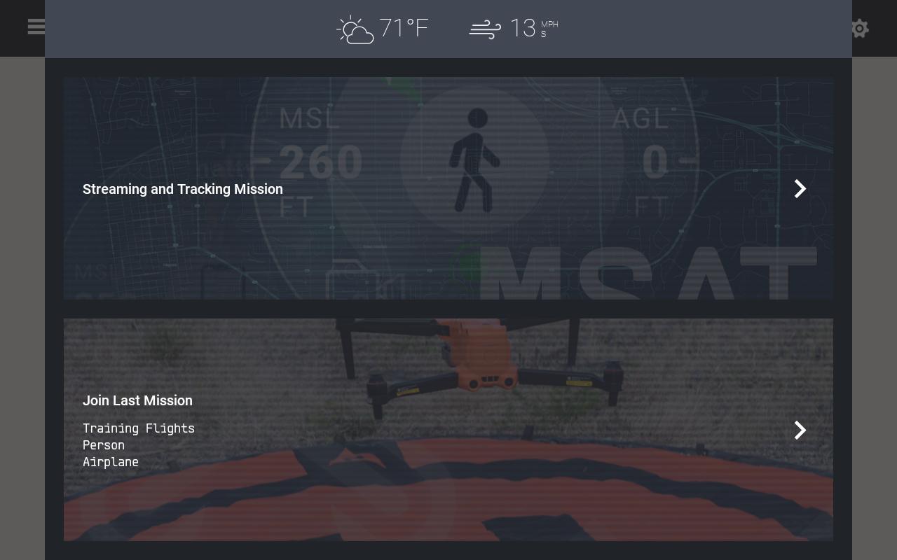
In the fast-paced world of public safety and emergency response, situational awareness is paramount. DroneSense brings you a purpose built platform designed to enhance on-scene coordination and decision-making. By turning every smartphone, tablet, drone, and even robots into a live broadcasting unit, we empower incident commanders and teams with unparalleled insights.
Why DroneSense CoPilot?
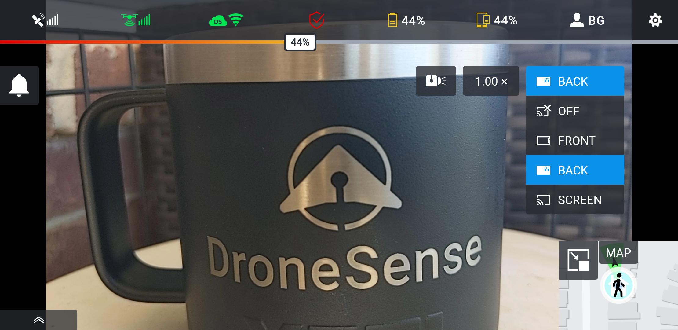
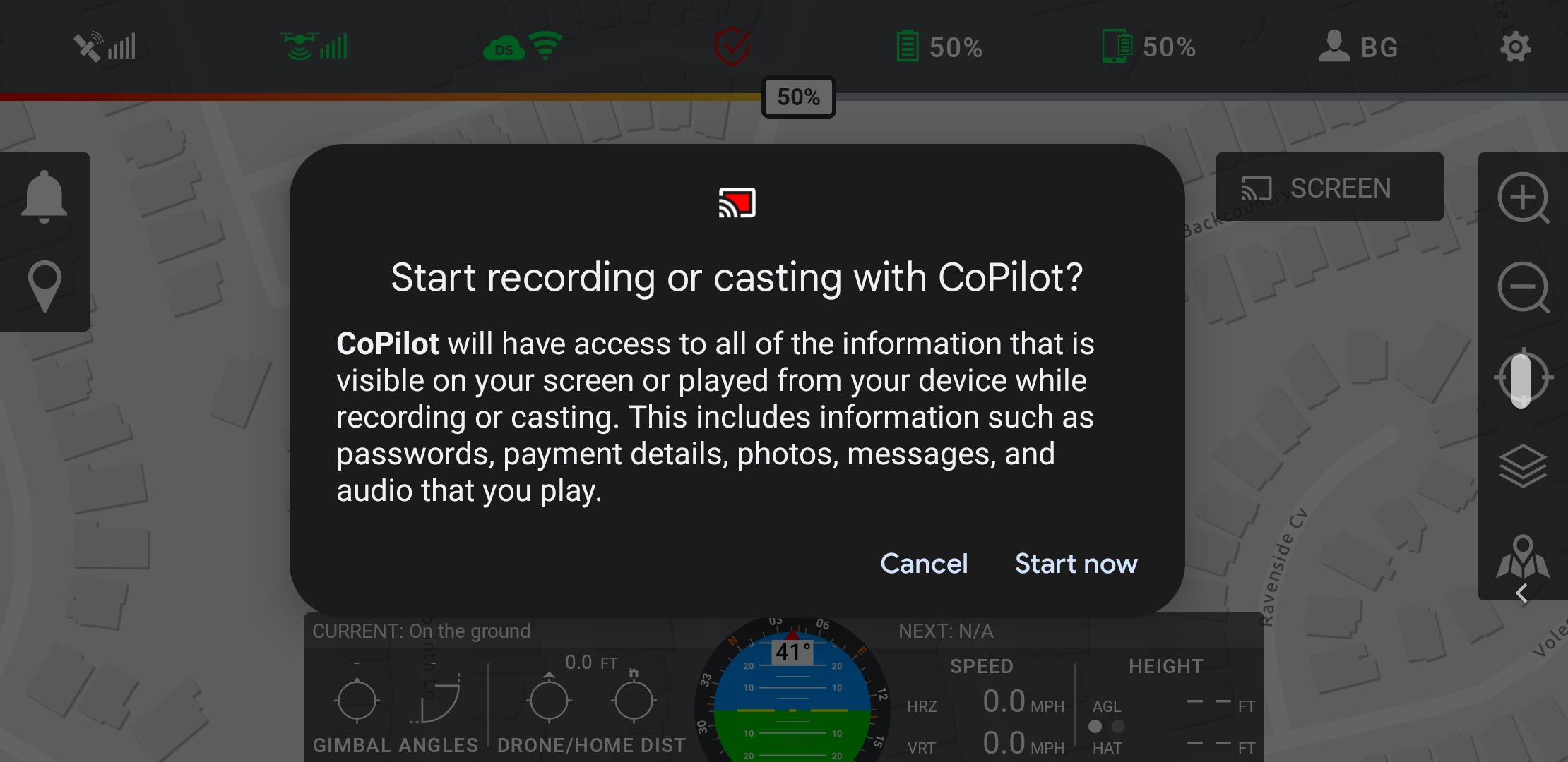
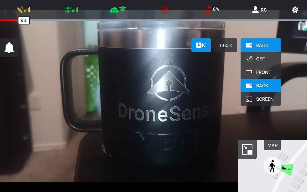
- Live Video Streaming: Share live video feeds from the ground or the sky directly with your command center. Whether it's a drone in flight or a mobile device in the hands of your team, DroneSense ensures that every angle is covered.
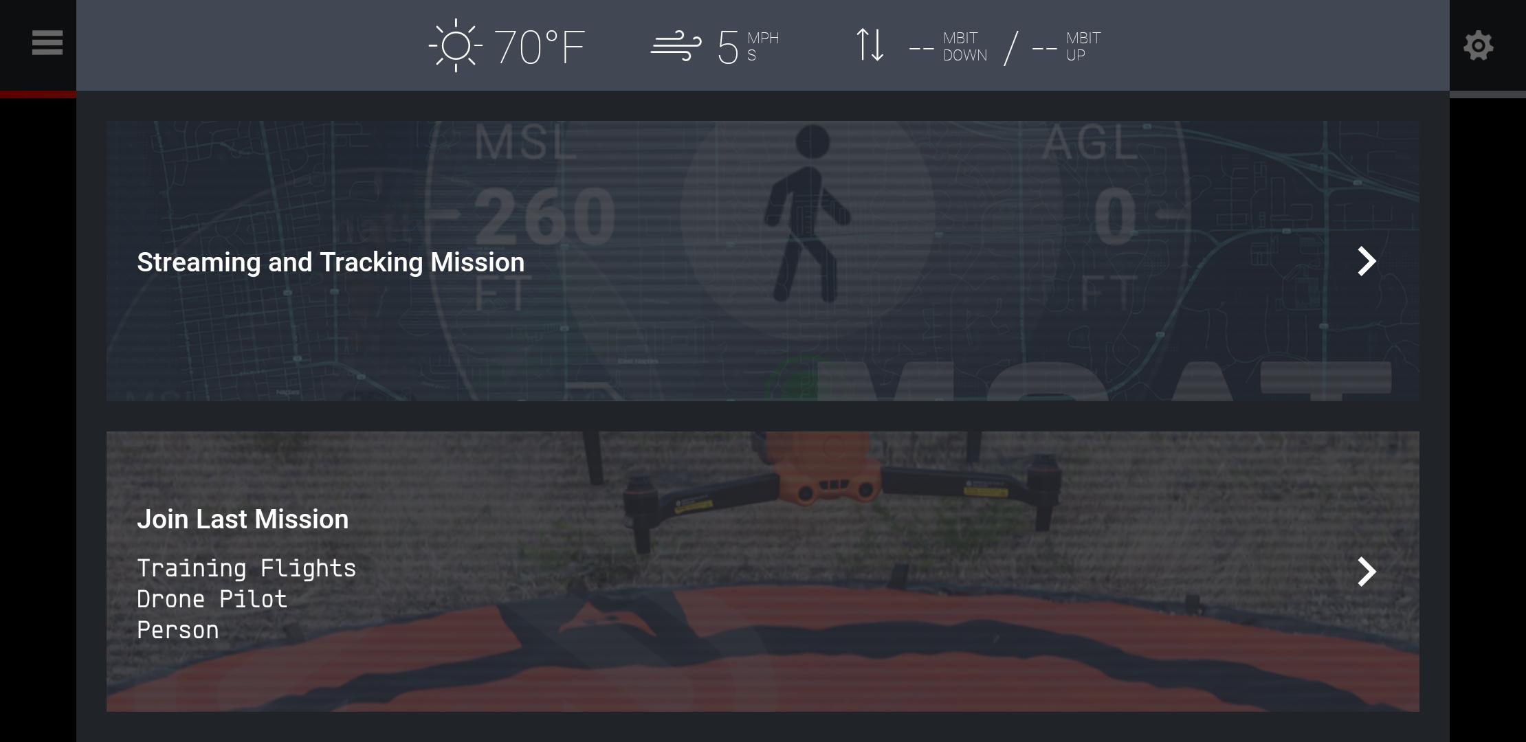
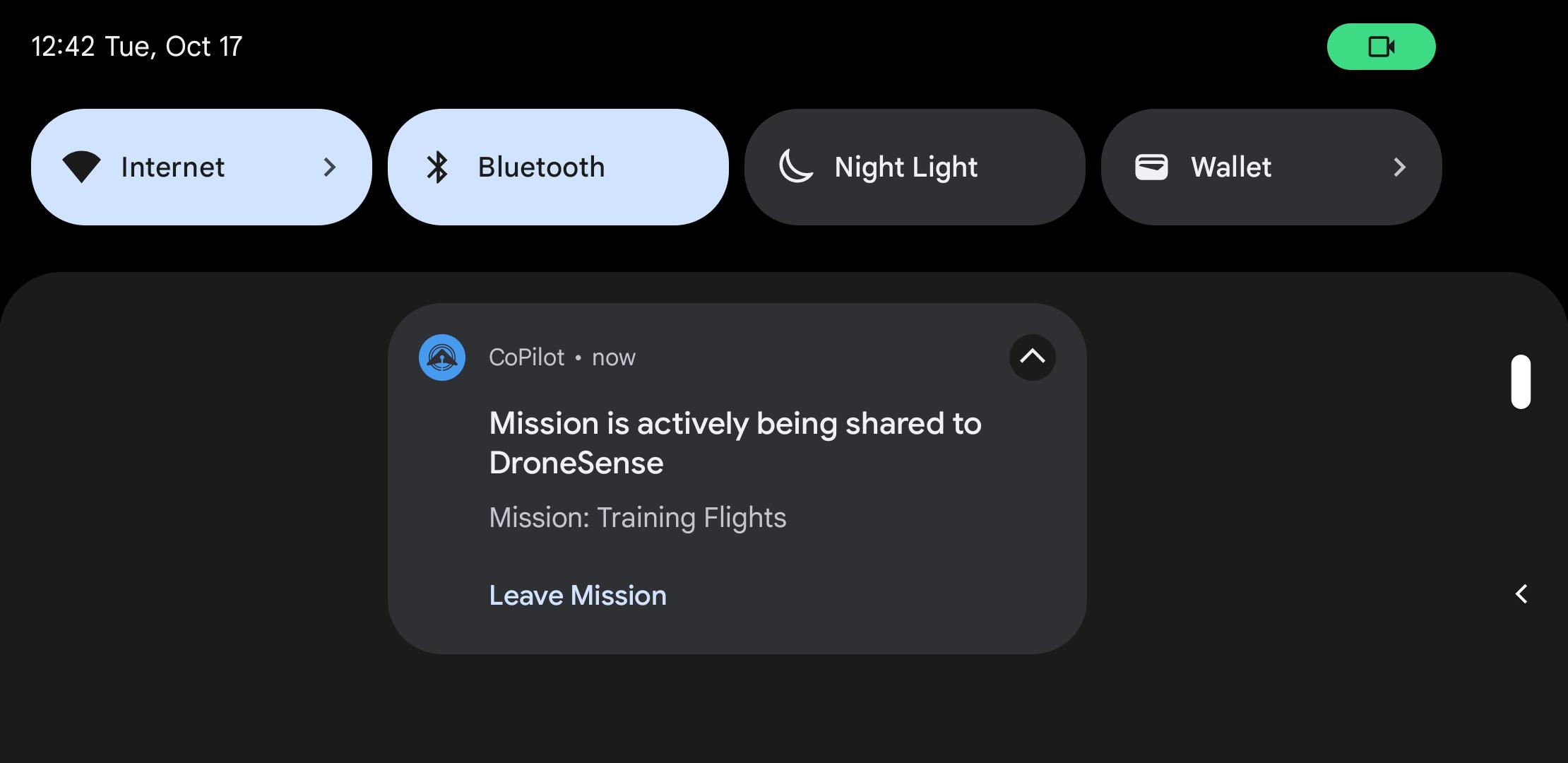
- GPS Location Sharing: Real-time tracking of all field assets provides a comprehensive operational picture. See the exact location of your teams, drones, and other assets, all live on an interactive map.
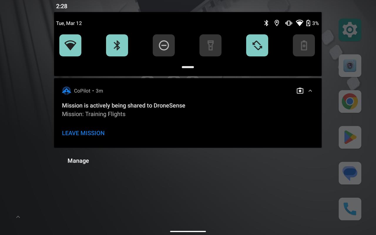
- Enhanced Collaboration: Not just a viewing platform, DroneSense allows you to interact with the operational map. Build a real time operational picture together with everyone in the mission. Strategize and communicate more effectively.
- Stream from Any Device: Screencast or share camera feeds from mobile devices to your mission's command and control center, DroneSense is as versatile as your needs.
Elevate your response now…
Imagine the power of having every cell phone, tablet, or camera-equipped device as part of your command center, providing live video streams and GPS locations from the field. With DroneSense, this is not just possible—it's easy.
Our platform is designed specifically for public safety professionals who demand quick, reliable, and comprehensive oversight of their operations. Whether you're managing a critical incident or coordinating a large-scale event, DroneSense gives you the eyes and insights you need to make informed decisions.
Download DroneSense CoPilot Today
Ready to transform your approach to public safety and emergency response? Download the CoPilot app now and turn your device into the ultimate tool for enhanced situational awareness and strategic decision-making.
What's New in the Latest Version 2024.6.10
Last updated on Jul 3, 2024
New and Improved:
- Improved speed when loading profiles and logging into app
Bug Fixes:
- Fixed issue where marker names changed on OpsHub were not reflected
- Fixed issue where creating new mission in OpsHub would disconnect any active streams
DroneSense CoPilot is a revolutionary software solution designed to empower drone operators with unparalleled safety and efficiency. This cutting-edge platform integrates advanced technologies to provide real-time situational awareness, enhanced obstacle detection, and automated flight planning, enabling operators to conduct missions with confidence and precision.
Enhanced Situational Awareness
DroneSense CoPilot utilizes advanced sensors and algorithms to create a comprehensive 3D map of the surrounding environment. This real-time data stream provides operators with a clear understanding of their surroundings, allowing them to make informed decisions and avoid potential hazards. The software's advanced object recognition capabilities identify and track obstacles, including buildings, trees, and power lines, ensuring safe navigation even in complex environments.
Automated Flight Planning
DroneSense CoPilot streamlines mission planning by automating the process. Operators simply input their desired flight path and objectives, and the software generates an optimized flight plan that takes into account obstacles, terrain, and wind conditions. This automated planning process saves time and reduces the risk of human error, ensuring smooth and efficient mission execution.
Enhanced Obstacle Detection
Beyond its situational awareness capabilities, DroneSense CoPilot incorporates sophisticated obstacle detection algorithms. These algorithms analyze real-time data from multiple sensors to identify and classify obstacles with exceptional accuracy. The software provides visual and audible alerts to operators, enabling them to take evasive action and avoid collisions.
Advanced Mission Management
DroneSense CoPilot offers a comprehensive suite of mission management tools. Operators can monitor the progress of multiple drones simultaneously, track flight data, and receive real-time updates on battery levels and other critical parameters. The software also enables remote control of drones, allowing operators to adjust flight paths and capture footage from a safe distance.
Improved Efficiency and Safety
The combination of enhanced situational awareness, automated flight planning, and advanced obstacle detection empowers drone operators to conduct missions with unprecedented efficiency and safety. By eliminating the risk of human error, reducing the time spent on planning, and providing real-time alerts, DroneSense CoPilot significantly improves the overall safety and productivity of drone operations.
Conclusion
DroneSense CoPilot is a game-changer for drone operators, providing them with the tools they need to safely and efficiently execute missions in complex environments. Its advanced technologies empower operators with unparalleled situational awareness, automated flight planning, and enhanced obstacle detection, enabling them to push the boundaries of drone capabilities and unlock new possibilities.
Elevate public safety with real-time video streaming and GPS tracking.
Elevate Public Safety with Real-Time Video Streaming and GPS Tracking
In the fast-paced world of public safety and emergency response, situational awareness is paramount. DroneSense brings you a purpose built platform designed to enhance on-scene coordination and decision-making. By turning every smartphone, tablet, drone, and even robots into a live broadcasting unit, we empower incident commanders and teams with unparalleled insights.
Why DroneSense CoPilot?
- Live Video Streaming: Share live video feeds from the ground or the sky directly with your command center. Whether it's a drone in flight or a mobile device in the hands of your team, DroneSense ensures that every angle is covered.
- GPS Location Sharing: Real-time tracking of all field assets provides a comprehensive operational picture. See the exact location of your teams, drones, and other assets, all live on an interactive map.
- Enhanced Collaboration: Not just a viewing platform, DroneSense allows you to interact with the operational map. Build a real time operational picture together with everyone in the mission. Strategize and communicate more effectively.
- Stream from Any Device: Screencast or share camera feeds from mobile devices to your mission's command and control center, DroneSense is as versatile as your needs.
Elevate your response now…
Imagine the power of having every cell phone, tablet, or camera-equipped device as part of your command center, providing live video streams and GPS locations from the field. With DroneSense, this is not just possible—it's easy.
Our platform is designed specifically for public safety professionals who demand quick, reliable, and comprehensive oversight of their operations. Whether you're managing a critical incident or coordinating a large-scale event, DroneSense gives you the eyes and insights you need to make informed decisions.
Download DroneSense CoPilot Today
Ready to transform your approach to public safety and emergency response? Download the CoPilot app now and turn your device into the ultimate tool for enhanced situational awareness and strategic decision-making.
What's New in the Latest Version 2024.6.10
Last updated on Jul 3, 2024
New and Improved:
- Improved speed when loading profiles and logging into app
Bug Fixes:
- Fixed issue where marker names changed on OpsHub were not reflected
- Fixed issue where creating new mission in OpsHub would disconnect any active streams
DroneSense CoPilot is a revolutionary software solution designed to empower drone operators with unparalleled safety and efficiency. This cutting-edge platform integrates advanced technologies to provide real-time situational awareness, enhanced obstacle detection, and automated flight planning, enabling operators to conduct missions with confidence and precision.
Enhanced Situational Awareness
DroneSense CoPilot utilizes advanced sensors and algorithms to create a comprehensive 3D map of the surrounding environment. This real-time data stream provides operators with a clear understanding of their surroundings, allowing them to make informed decisions and avoid potential hazards. The software's advanced object recognition capabilities identify and track obstacles, including buildings, trees, and power lines, ensuring safe navigation even in complex environments.
Automated Flight Planning
DroneSense CoPilot streamlines mission planning by automating the process. Operators simply input their desired flight path and objectives, and the software generates an optimized flight plan that takes into account obstacles, terrain, and wind conditions. This automated planning process saves time and reduces the risk of human error, ensuring smooth and efficient mission execution.
Enhanced Obstacle Detection
Beyond its situational awareness capabilities, DroneSense CoPilot incorporates sophisticated obstacle detection algorithms. These algorithms analyze real-time data from multiple sensors to identify and classify obstacles with exceptional accuracy. The software provides visual and audible alerts to operators, enabling them to take evasive action and avoid collisions.
Advanced Mission Management
DroneSense CoPilot offers a comprehensive suite of mission management tools. Operators can monitor the progress of multiple drones simultaneously, track flight data, and receive real-time updates on battery levels and other critical parameters. The software also enables remote control of drones, allowing operators to adjust flight paths and capture footage from a safe distance.
Improved Efficiency and Safety
The combination of enhanced situational awareness, automated flight planning, and advanced obstacle detection empowers drone operators to conduct missions with unprecedented efficiency and safety. By eliminating the risk of human error, reducing the time spent on planning, and providing real-time alerts, DroneSense CoPilot significantly improves the overall safety and productivity of drone operations.
Conclusion
DroneSense CoPilot is a game-changer for drone operators, providing them with the tools they need to safely and efficiently execute missions in complex environments. Its advanced technologies empower operators with unparalleled situational awareness, automated flight planning, and enhanced obstacle detection, enabling them to push the boundaries of drone capabilities and unlock new possibilities.


