


Find nearby places, GPS navigation and live satellite street view map
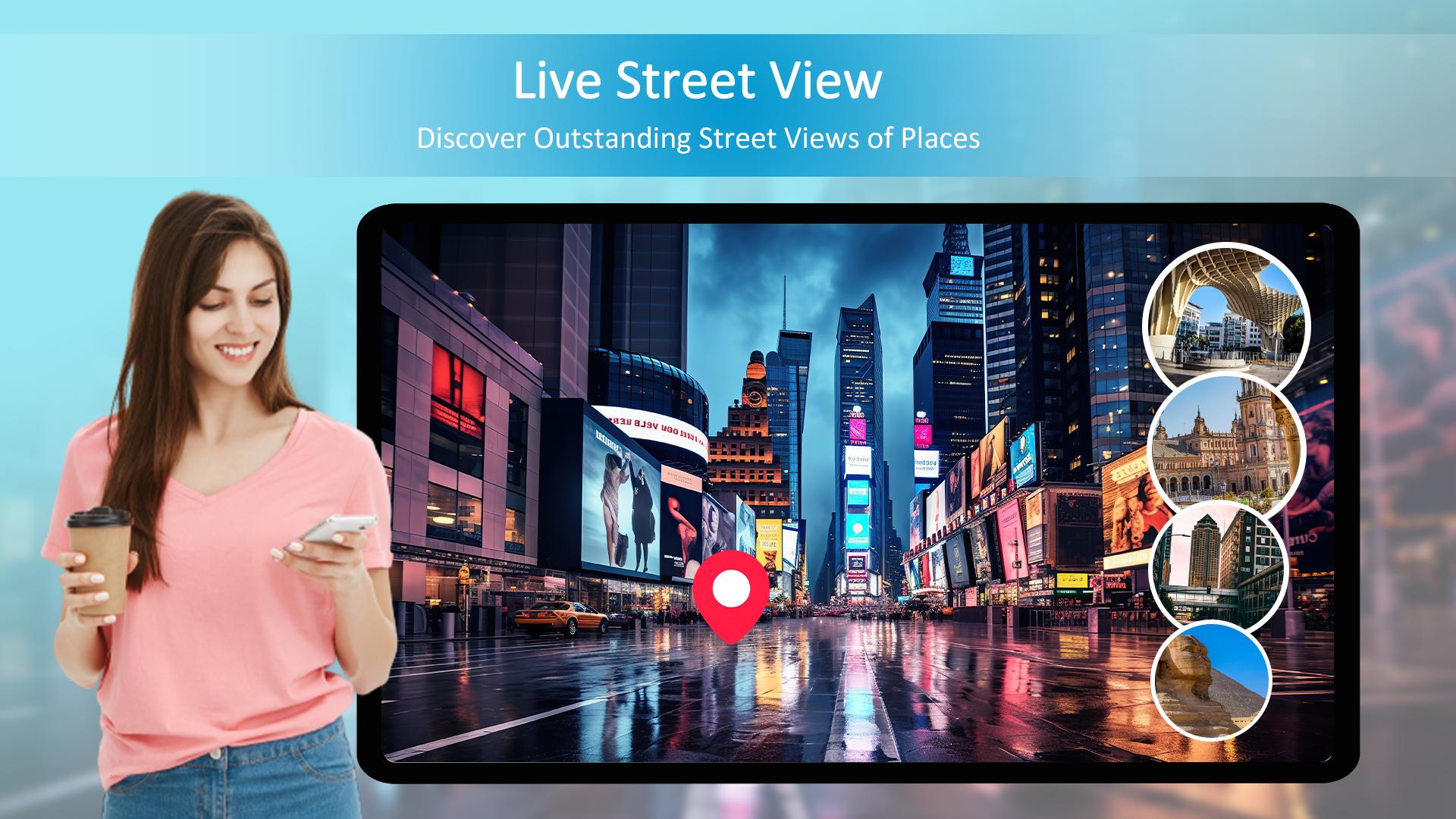
Street View: Satellite Map gives a 360-degree view of sites all around the world by offering a digital panorama of streets, landscapes, and interiors. Live Street View lets users visually explore cities, neighborhoods, landmarks, and natural wonders from the comfort of their devices by combining high-resolution images, GPS data, and mapping technologies.
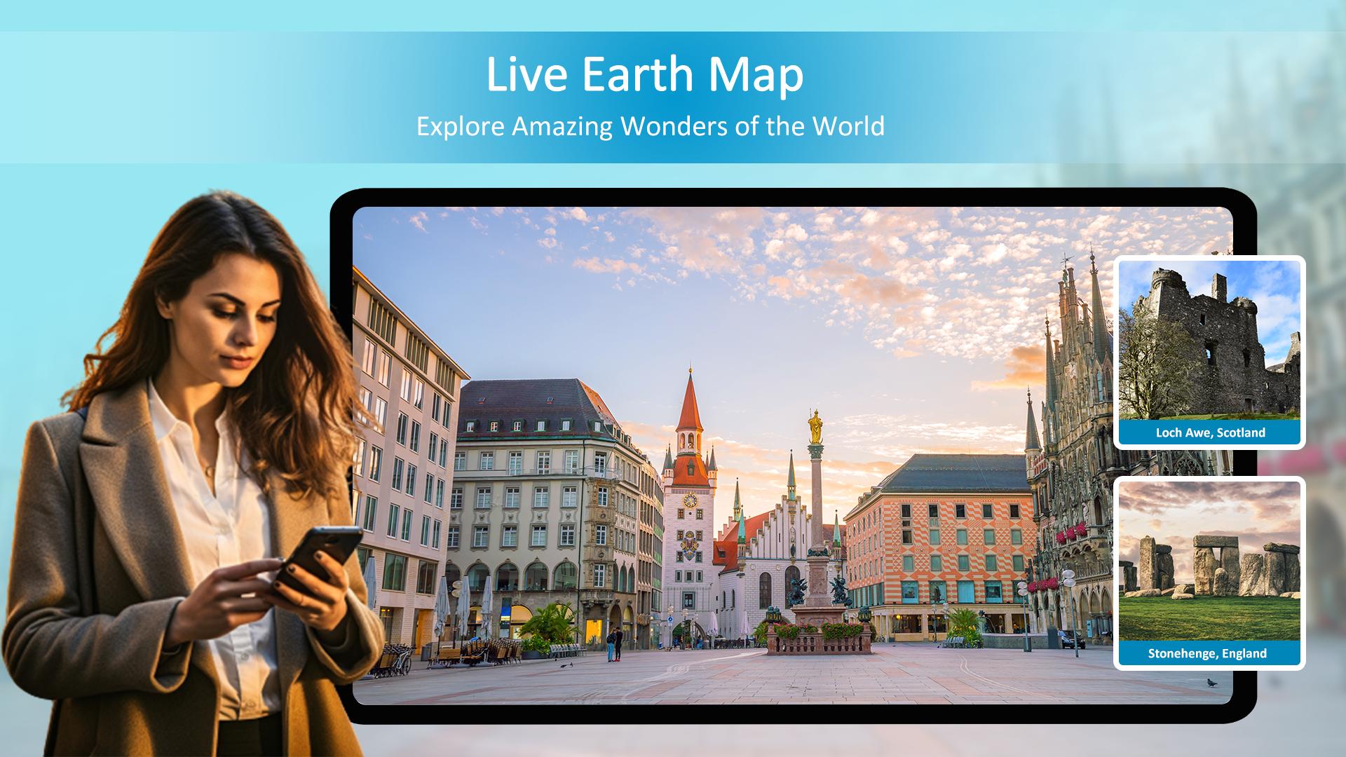
When you step outside of the city, Street View Enhancer or Street View Traveler takes you to far-off places and breathtaking scenery. Discover the scenic coastal highways with their meandering roadways, travel through verdant forests and undulating hillsides, or be in awe of the magnificence of famous sites like the Taj Mahal and the Eiffel Tower. Street View live earth map is an engaging and educational way to explore the world, whether you're simply satiating your curiosity or planning a vacation.
However, Street View: Satellite Map isn't just available in outdoor settings. Through collaborations with establishments and organizations, patrons can enter museums, eateries, retail stores, and others.
With the Street View app or live street view for android, you can explore the world from the comfort of your mobile device in a way that is both immersive and interactive. 360 Street View rich features and easy-to-use design enable users to easily return to familiar areas, discover new destinations, and go on virtual excursions with GPS Navigation.
The enormous collection of panoramic photos street view 3d that earth map live fleet of camera-equipped cars, along with user and reliable photographer contributions swansea street map, provide as the foundation of the Street View: Satellite Map. With breathtaking clarity, the live street view presents a diverse range of locales to visit, ranging from busy metropolitan streets to isolated wilderness areas Live Satellite map or live satellite view.
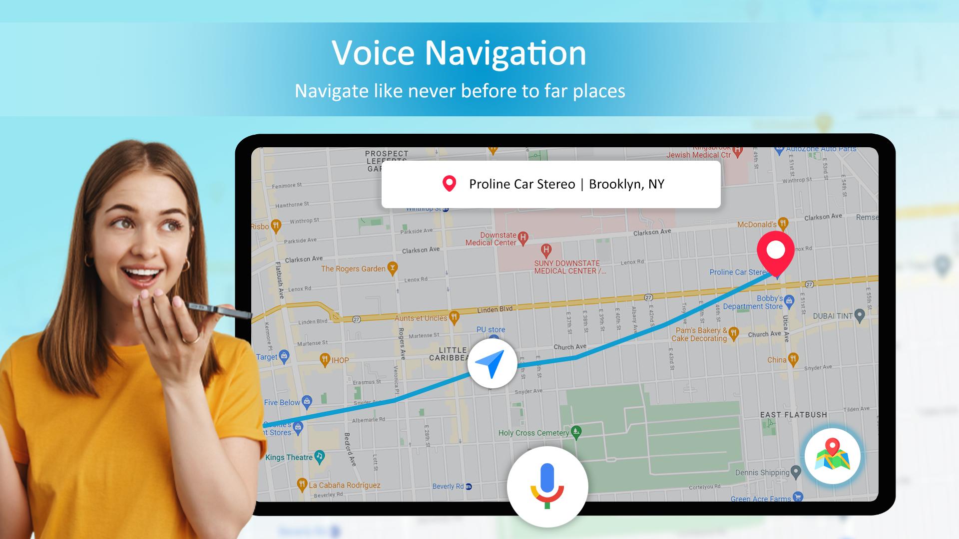
Route planner street view map users may navigate the virtual environment effortlessly and with ease because of its smooth and intuitive navigation. GPS navigation and street view offer a seamless and responsive experience that makes you feel as though you're there, whether you're using touch gestures to pan and zoom or just tilting your device to change your perspective.
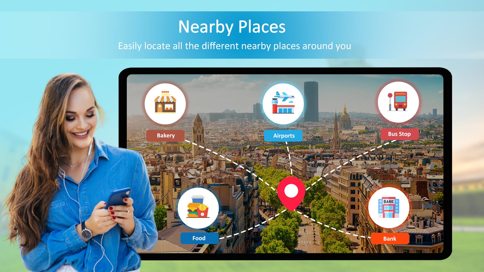
However, Streetview live is more than simply a tool for tourism; it's also an effective instrument for planning and research. Do you need help getting to a certain address? You just need to type it into the search area, and the app will help you visualize your journey by providing turn-by-turn navigation and a Street View of my house. Are you trying to find a hotel, restaurant, or attraction nearby? You can find points of interest based on your location, interests, and preferences with the app's built-in Nearby places module. A variety of tools for creating and sharing 360-degree photos or live satellite view are available on the earth map free for users who wish to add their images to the platform
What's New in the Latest Version 2.0.2
Last updated on Jul 3, 2024
Enjoy new features
Street View: Satellite MapIntroduction
Street View: Satellite Map is an immersive mobile application that seamlessly blends street-level imagery with satellite maps, providing users with an unparalleled perspective of the world. This cutting-edge technology empowers users to explore distant locations, navigate unfamiliar cities, and discover hidden gems from the comfort of their own devices.
Key Features
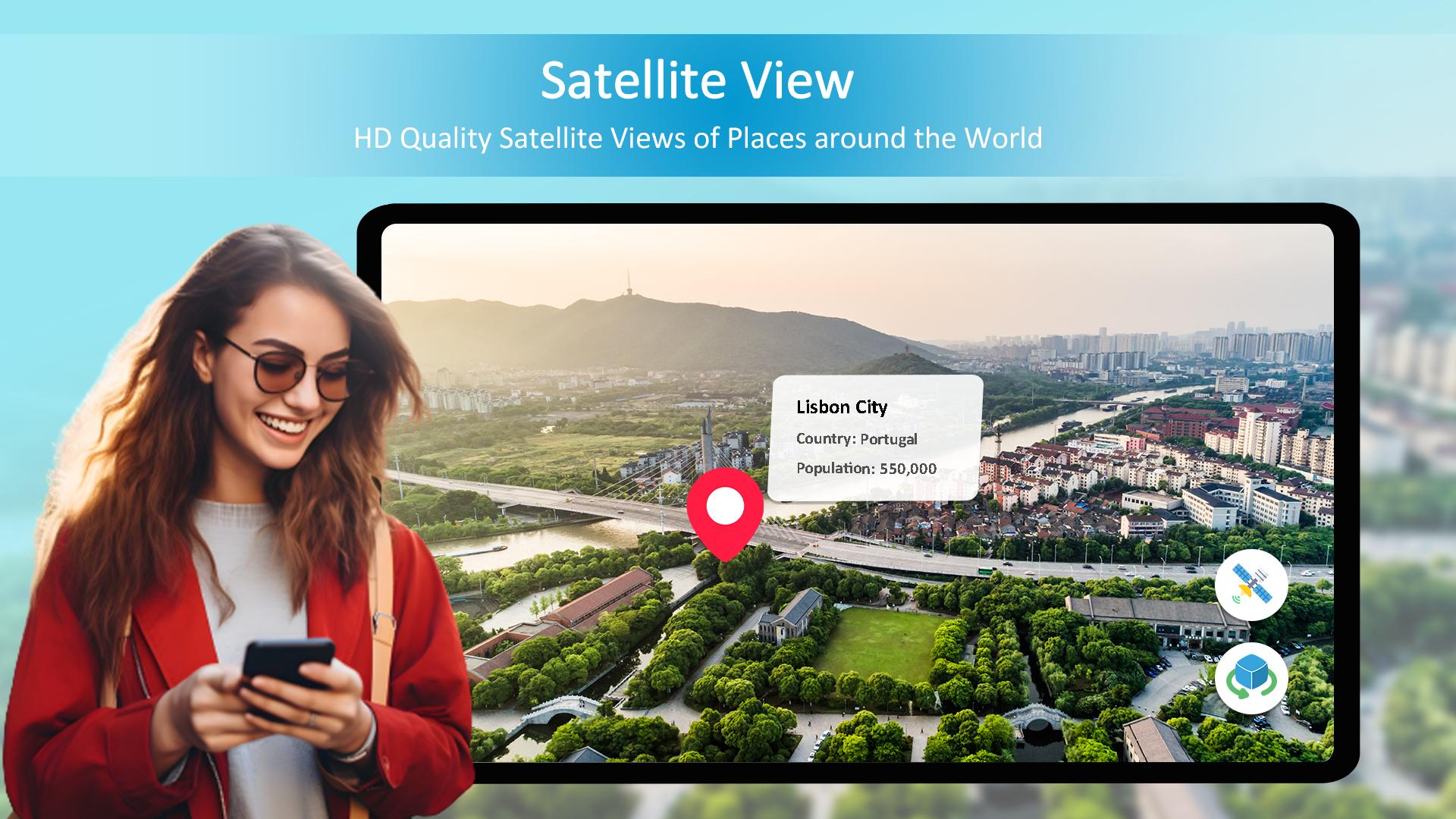
* Satellite Map Integration: Street View: Satellite Map seamlessly integrates high-resolution satellite imagery with street-level photography, allowing users to switch between the two views effortlessly. This feature provides a comprehensive overview of an area, enabling users to quickly identify landmarks, streets, and buildings.
* Street-Level Exploration: The application allows users to navigate through street-level imagery as if they were actually walking down the streets. This immersive experience enables users to explore neighborhoods, discover local businesses, and even peek inside buildings with a virtual tour.
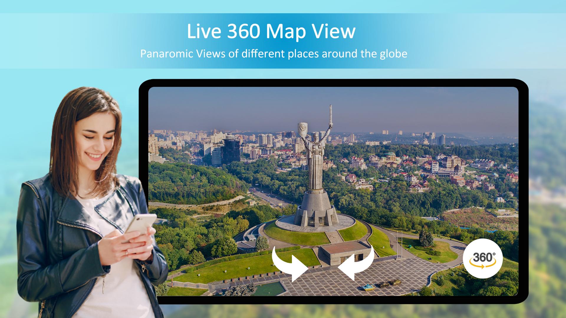
* 360-Degree Views: Street View: Satellite Map offers panoramic 360-degree views, allowing users to explore an area from any angle. This feature is particularly useful for planning trips, checking out potential destinations, or simply satisfying curiosity.
* Navigation and Search: The application provides robust navigation and search capabilities, making it easy to find specific locations, plan routes, and discover points of interest. Users can search for addresses, landmarks, or categories such as restaurants, hotels, or museums.
* Offline Mode: Street View: Satellite Map offers an offline mode, allowing users to download and store map data for later use. This feature is invaluable for travelers who want to access maps and navigation without incurring roaming charges.
Benefits
Street View: Satellite Map offers numerous benefits for users, including:
* Enhanced Travel Planning: The application empowers travelers to explore potential destinations virtually, plan efficient routes, and identify local attractions before embarking on their journeys.
* Virtual Exploration: Users can satisfy their curiosity and explore distant locations from the comfort of their own homes. This feature is particularly beneficial for those who are unable to travel due to physical or financial constraints.
* Improved Navigation: Street-level imagery and satellite maps provide a comprehensive navigational experience, helping users find their way around unfamiliar cities or discover hidden paths.
* Local Business Discovery: The application helps users discover local businesses, restaurants, and services in their area or in destinations they are planning to visit.
Conclusion
Street View: Satellite Map is a groundbreaking mobile application that combines the power of satellite maps with the immersive experience of street-level photography. This technology revolutionizes the way we explore the world, enabling us to plan trips, navigate cities, and discover hidden gems with unprecedented ease and convenience.
Find nearby places, GPS navigation and live satellite street view map
Street View: Satellite Map gives a 360-degree view of sites all around the world by offering a digital panorama of streets, landscapes, and interiors. Live Street View lets users visually explore cities, neighborhoods, landmarks, and natural wonders from the comfort of their devices by combining high-resolution images, GPS data, and mapping technologies.
When you step outside of the city, Street View Enhancer or Street View Traveler takes you to far-off places and breathtaking scenery. Discover the scenic coastal highways with their meandering roadways, travel through verdant forests and undulating hillsides, or be in awe of the magnificence of famous sites like the Taj Mahal and the Eiffel Tower. Street View live earth map is an engaging and educational way to explore the world, whether you're simply satiating your curiosity or planning a vacation.
However, Street View: Satellite Map isn't just available in outdoor settings. Through collaborations with establishments and organizations, patrons can enter museums, eateries, retail stores, and others.
With the Street View app or live street view for android, you can explore the world from the comfort of your mobile device in a way that is both immersive and interactive. 360 Street View rich features and easy-to-use design enable users to easily return to familiar areas, discover new destinations, and go on virtual excursions with GPS Navigation.
The enormous collection of panoramic photos street view 3d that earth map live fleet of camera-equipped cars, along with user and reliable photographer contributions swansea street map, provide as the foundation of the Street View: Satellite Map. With breathtaking clarity, the live street view presents a diverse range of locales to visit, ranging from busy metropolitan streets to isolated wilderness areas Live Satellite map or live satellite view.
Route planner street view map users may navigate the virtual environment effortlessly and with ease because of its smooth and intuitive navigation. GPS navigation and street view offer a seamless and responsive experience that makes you feel as though you're there, whether you're using touch gestures to pan and zoom or just tilting your device to change your perspective.
However, Streetview live is more than simply a tool for tourism; it's also an effective instrument for planning and research. Do you need help getting to a certain address? You just need to type it into the search area, and the app will help you visualize your journey by providing turn-by-turn navigation and a Street View of my house. Are you trying to find a hotel, restaurant, or attraction nearby? You can find points of interest based on your location, interests, and preferences with the app's built-in Nearby places module. A variety of tools for creating and sharing 360-degree photos or live satellite view are available on the earth map free for users who wish to add their images to the platform
What's New in the Latest Version 2.0.2
Last updated on Jul 3, 2024
Enjoy new features
Street View: Satellite MapIntroduction
Street View: Satellite Map is an immersive mobile application that seamlessly blends street-level imagery with satellite maps, providing users with an unparalleled perspective of the world. This cutting-edge technology empowers users to explore distant locations, navigate unfamiliar cities, and discover hidden gems from the comfort of their own devices.
Key Features
* Satellite Map Integration: Street View: Satellite Map seamlessly integrates high-resolution satellite imagery with street-level photography, allowing users to switch between the two views effortlessly. This feature provides a comprehensive overview of an area, enabling users to quickly identify landmarks, streets, and buildings.
* Street-Level Exploration: The application allows users to navigate through street-level imagery as if they were actually walking down the streets. This immersive experience enables users to explore neighborhoods, discover local businesses, and even peek inside buildings with a virtual tour.
* 360-Degree Views: Street View: Satellite Map offers panoramic 360-degree views, allowing users to explore an area from any angle. This feature is particularly useful for planning trips, checking out potential destinations, or simply satisfying curiosity.
* Navigation and Search: The application provides robust navigation and search capabilities, making it easy to find specific locations, plan routes, and discover points of interest. Users can search for addresses, landmarks, or categories such as restaurants, hotels, or museums.
* Offline Mode: Street View: Satellite Map offers an offline mode, allowing users to download and store map data for later use. This feature is invaluable for travelers who want to access maps and navigation without incurring roaming charges.
Benefits
Street View: Satellite Map offers numerous benefits for users, including:
* Enhanced Travel Planning: The application empowers travelers to explore potential destinations virtually, plan efficient routes, and identify local attractions before embarking on their journeys.
* Virtual Exploration: Users can satisfy their curiosity and explore distant locations from the comfort of their own homes. This feature is particularly beneficial for those who are unable to travel due to physical or financial constraints.
* Improved Navigation: Street-level imagery and satellite maps provide a comprehensive navigational experience, helping users find their way around unfamiliar cities or discover hidden paths.
* Local Business Discovery: The application helps users discover local businesses, restaurants, and services in their area or in destinations they are planning to visit.
Conclusion
Street View: Satellite Map is a groundbreaking mobile application that combines the power of satellite maps with the immersive experience of street-level photography. This technology revolutionizes the way we explore the world, enabling us to plan trips, navigate cities, and discover hidden gems with unprecedented ease and convenience.


